top of page
Future Bus Map
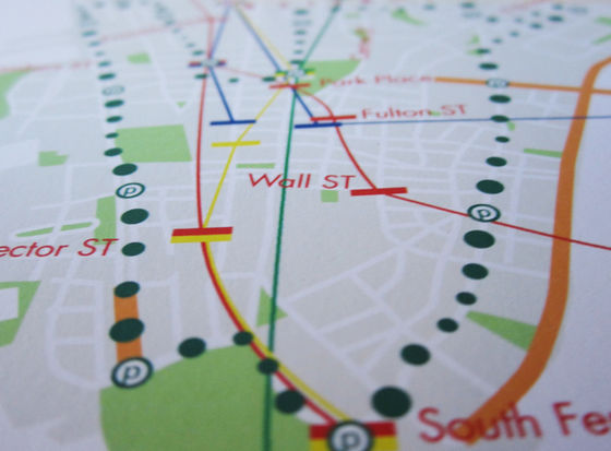
The task was to imagine 5 years into the future from 2013.
I thought it would be possible to have traffic in the air by 2018, so I designed a map that would be used during that time. To the left is an infographic map of Manhattan, having dots to signify the traveling of the bus in the air. The bus is also connected to the subway.
36 x 12 in
マンハッタンのインフォグラフィック地図になります。課題は2013年から5年後の世界を想像することでした。2018年までには空中での交通があると想像しました
ので、その間に使用されるインフォグラフィックの地図をデザインしました。
左には、私の想像した未来のマンハッタン地図に
なります。空中でのバス停や移動ルートを表すサイズの違う点があります。また、バス停は地下鉄にアクセス
しやすい場所に位置づけております。
36 x 12 in
こちらは、大学での課題の一つになります。
bottom of page


